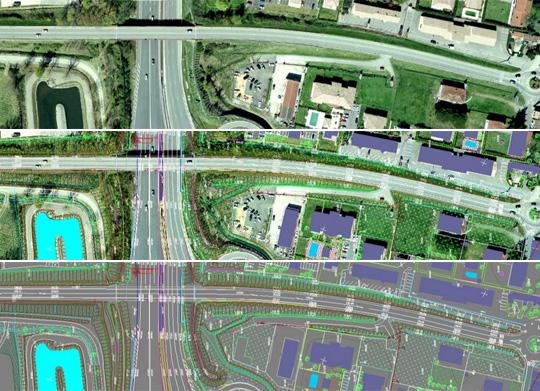
Geocad 93 Ltd. offers geodesy and geodesic services:
- Preparation of projects for modification of cadastre maps
- Tracing of property boundaries
- Tracing of buildings
- Partitioning of land
- Filming of constructed buildings, underground communications and issuing of Certificate under Art.52, paragraph 4 CPRA
- Preparation of detailed development plans
- Preparation of topographical plans
- Developing of projects for vertical planning
- Design of vertical alignment projects
- Filming of facades and development of 3-D model of buildings
- Digitalization of mapped materials
- Highprecision 3D laser scanning
- Aero triangulation
- Mapping the terrain and situation from aerial photos
- Production of orthophoto plans
- Scanning of aerial photos from different photographic carriers
- Determining the volume of earthwork
GEOCAD-93 Ltd employs 40 engineers, surveyors and 20 technical assistants. All employees in the company are highly qualified, which is a prerequisite projects constructed by GEOKAD-93 to be of the highest quality. At present the company has established a cadastral map and cadastral registers of Dupnitsa, Dimitrovgrad, part of Pernik, part of Maritsa Municipality and Ovcha kupel - Sofia. Digitalization of Burgas is made; specialized maps for lay-out planning of part of Pleven, part of Gorna Banya and Suhodol have been created.
The company GEOCAD-93 was established in January 1993. The owner of the company is engineer Zlatan Zlatanov. In the beginning, the company focused on reinstating land owners in their possessions. By 1995, plans for land division in 6 villages in the region of Targovishte were made. Since 1995 GEOKAD-93 has been working primarily with architectural offices and construction companies, carrying out shooting plots to design projects for vertical planning and tracing of plots and other buildings. Since 2004 the company has drawn more than 29,000 such sites. Under contracts with the Capital Municipality the company GEOCAD-93 has drawn and continues to draw vertical alignment projects of a large number of regulatory plans on the territory of Sofia. Thus the company has established itself as one of the leading geodesic companies in the capital. After 2001, with the entry into force of the Law on Cadastre and Property Register, the company GEOCAD-93 is actively involved in the process of creating cadastral maps and registers. A Photogrammetric department was established in the company GEOCAD-93 in 2004. It is equipped with 3 photogrammetric stations, based on the PHOTOMOD system, and a photogrammetric scanner Delta Scan 470.


